Historic maps of Charlestown - 18th Century
Grundriss von der Stadt Boston und ihren Gegenden.
From Allgemeine Historie der Reisen zu Wasser und Lande, Leipzig,
Arkstee & Merkus, 1758. 1:45,000.
Plan de la ville et du port de Boston; capitale de
la Nouvelle Angleterre.
Paris, Chés Lattré [1764?] ca. 1:11,300.
A plan of Boston in New England with its environs ...
Engrav'd in aqua tinta by Francis Jukes.
London, 1777. ca. 1:14,000.
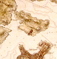
Plan of the heights of Charles Town, &c. R: W: Lieut.: R. W. F.
Boston, Dec. 13, 1775.
ca. 1:6,000.
1781
Source (1781 map from Mapping Boston)
Back to Charlestown
page